The Ganga Canal is an engineering marvel that has shaped centuries of cultural identity and vernacular architecture. Conceived in the mid-19th century, this canal system brought life-giving water to arid lands and, in the process, became a crucible for cultural exchange, architectural innovation, and community formation. A new study by researchers at the Indian Institute of Technology (IIT) Roorkee has examined the imprint the canal system has left along its length. Their study reveals that the Ganga Canal was more than a mere waterway; It was a dynamic cultural corridor with profound historical and societal significance.
The impetus for the massive Ganges Canal system was the devastating Agra famine of 1837–38. The catastrophic failure of the summer monsoon added to a host of other factors, which eventually led to the starvation of around 800,000 people across the fertile Doab region in present-day Uttar Pradesh of North West India. This prompted the British East India Company to seek a permanent solution to stabilise the land between the Ganges and Yamuna rivers. Proby Thomas Cautley, an engineer who was commissioned as a second lieutenant in the Bengal Presidency artillery in Calcutta, was the driving force behind the canal's construction. Despite several objections, he managed to convince the British East India Company to invest in the massive undertaking.
Construction of the canal commenced in 1842 as part of a project intended to famine-proof the essential agricultural belt. While its primary function was irrigation, transforming vast stretches of western Uttar Pradesh into fertile farmlands, its impact stretched far beyond agriculture. The new study uncovers a rich heritage, both tangible – like the heritage structures – and intangible – like the festivals and cultures – that has evolved over pre-colonial, colonial, and post-colonial periods.
Did You Know? The construction was a major undertaking that required Cautley to make his own bricks, brick kilns, and mortar. He also had to overcome significant cultural challenges, including agreeing to leave a gap in the dam for the water to flow unchecked |
The IIT Roorkee team’s research focused on the canal route from Haridwar to Roorkee. Archival research formed the bedrock of their study. They dove into historical documents, old maps, government records, and construction blueprints, including Sir Proby T. Cautley's original "Report on the Ganges Canal Works" and "The Ganga Canal; Illustrated by Photographs, T. G. Glover, 1867." These invaluable resources, retrieved from the M.G. Central Library at IIT Roorkee and other online archives, provided crucial historical context, tracing the canal's construction and its early relationship with the built environment. A document survey of existing literature on canal heritage globally also provided a theoretical framework, allowing the researchers to contextualise their findings within broader academic discourse.
Photographic documentation was key to understanding the present. From August to October 2024, the team systematically photographed the canal and its adjoining structures from Haridwar to Roorkee. These photographs captured architectural details, materials, and the current condition of tangible heritage, allowing for a visual comparison with historical images and providing a snapshot of its contemporary state.
The team also conducted interviews with locals and other stakeholders, which brought the human element into the study. Six non-structured interviews were conducted with a diverse group, including workers at Dharoni, residents of Bheemgoda and Dhanori, shopkeepers, members of the gwala community (milkmen), and caretakers of the Dam Bungalow at Haridwar. These personal narratives offered invaluable insights into how the canal influenced architectural styles, building practices, and socio-cultural dynamics over time. The researchers used a combination of convenience and snowball sampling to ensure a broad range of perspectives.
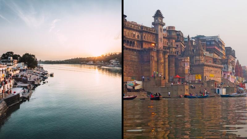
The researchers found that the canal route is a living museum, showcasing religious devotion, colonial ambition, and engineering prowess. In Haridwar, the 'gateway to the gods', the canal flows alongside sacred ghats and ancient temples, deeply intertwined with Hindu spiritual practices. As one moves towards Roorkee, the landscape shifts, revealing a strong colonial imprint: bungalows, workshops, powerhouses, and churches stand as testaments to British engineering and administration. Yet these colonial structures often coexist with local religious sites, like the prominent Muslim Sufi shrine of Piran Kaliyar, highlighting a cultural confluence.
Beyond individual structures, the canal itself is an engineering marvel. The study highlights super passages and aqueducts, like the Solani Aqueduct, which allowed rivers to flow beneath the canal, demonstrating ingenious solutions to complex hydrological challenges. These feats facilitated water flow and spurred the establishment of institutions such as the Thomson College of Civil Engineering (now IIT Roorkee) in 1847, born of the need for skilled engineers to manage such ambitious projects. The canal also played a pivotal role in industrial development, with workshops and iron foundries established to support its construction and maintenance.
Apart from the stone and brick, the canal's legacy thrives in the daily lives and traditions of the people along its banks. The researchers documented the intangible heritage, including vibrant festivals such as the Hindu Kawar Yatra, in which devotees carry Ganga Jal(water from the Ganga River), transforming the canal route into a pilgrimage corridor. Similarly, the Piran Kaliyar Mela, an annual Islamic festival, draws pilgrims to the Sufi shrine, further cementing the canal's role as a shared spiritual space. Daily rituals such as sacred bathing, fishing, and cloth washing at designated dhobi ghats continue to animate the canal's edges, making it a dynamic public space for leisure, livelihood, and social interaction. Even small-scale economic activities along the canal contribute to its vibrant, multifunctional character.
By integrating spatial analysis (mapping heritage sites), field-based observation (photographic documentation and interviews), and cultural interpretation, the researchers bridged the traditional gap between heritage studies and infrastructural history. This allowed them to analyse the canal not just as a physical structure, but as a site of layered meanings, social interactions, and evolving cultural identities. However, the study acknowledges that it is a context-specific, single-case study (Haridwar to Roorkee), and its findings are not intended to be universally generalizable to all canal landscapes. It provides deep insights into one historically significant and culturally active corridor, rather than a broad overview.
The research underscores the urgent need for integrated conservation strategies to protect this layered cultural landscape from neglect, unplanned development, and the pressures of modern tourism. By recognising the canal's unique cultural identity, the study opens pathways for sustainable tourism and heritage preservation, fostering community-led revitalisation efforts.
This article was written with the help of generative AI and edited by an editor at Research Matters.


