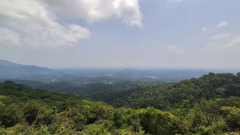
Karnataka, the eighth largest state of India in terms of population, is a land of diversity. From the bustling cities to dense forests, the state is rich in resources and biodiversity. The Western Ghats region in Karnataka is identified as particularly rich in natural resources and ecologically sensitive, making it a top priority for conservation efforts. How can policy makers decide which regions within the state needs the most protection to best conserve Earth's precious natural resources?
To answer this, researchers T. V. Ramachandra and team from the Indian Institute of Science (IISc), Bengaluru have developed a framework to rank regions by the availability of natural resources, focusing on the diverse landscapes of Karnataka. Their work aims to create a roadmap for conservation, ensuring that our natural heritage is preserved for generations to come.
The core of this research is about identifying and prioritising what the researchers call Natural Resource Rich Regions or NRRZs. These can be hotspots of biodiversity and ecological importance or region rich in other natural resources. To find these areas, the researchers zoomed in, dividing the entire state of Karnataka into 9 km by 9 km grids. This level of detail is key because it allows them to understand the unique conditions and resources present in each small area. They then gathered data, covering everything from the types of forests and the amount of carbon they store to the local climate, water sources, and even the human populations living in these regions.
Next, the team used a technique called spatial integration, each square (grid) has information layered onto it. They looked at land use changes over time, analysing satellite data to see how forests have been affected by deforestation and development. They also examined forest fragmentation, the process by which intact forests are being broken up into smaller pieces. For the ecological data, they measured things like biomass (the total amount of organic matter in plants), species diversity (how many different types of plants and animals are present), and the presence of endemic species (those found only in that specific region).
Did you know? Forests are shrinking: The study highlights that forest cover in Karnataka has decreased from 21% in 1985 to 15% in 2019, showing the impact of human activities like industrialisation and urbanisation. |
The geo-climatic aspect involved looking at factors like altitude, slope, and rainfall. They also considered energy resources like solar and wind potential, and social factors such as population density and the presence of tribal communities who often have deep traditional knowledge of the land. Each of these factors was assigned a weight based on its importance for conservation. For example, areas with high biodiversity or significant carbon storage received higher weights. By combining all these weighted factors for each grid, they could calculate an overall composite metric score. This score then allowed them to categorise the grids into four levels of NRRZs, from NRRZ1 (the most resource-rich and ecologically sensitive) to NRRZ4 (the least resource-rich and most impacted). Interestingly, the study found that 32% of Karnataka's geographical area falls into the NRRZ1 and NRRZ2 categories, highlighting the urgent need for focused conservation efforts in these zones.
The detailed, grid-by-grid approach and the integration of the different types of data recognises that ecosystems are complex and interconnected. Looking at the interplay between land, climate, biodiversity, and human activity, enabled the researchers to better categorise the regions, which allows for a more accurate and actionable conservation plan. The researchers however acknowledge that while their method is robust, the dynamic nature of ecosystems means that continuous monitoring and updating of data are essential.
By identifying areas which represent the most ecologically sensitive and resource-rich regions, policymakers can implement stricter conservation measures. This means protecting these areas from harmful development, promoting sustainable land use, and ensuring that human activities do not further degrade these vital ecosystems. The work provides a scientific basis for making informed decisions that can help maintain the ecological balance, protect biodiversity, and ensure the long-term well-being of both nature and the people who depend on it. It’s a crucial step towards a more sustainable future.
This article was written with the help of generative AI and edited by an editor at Research Matters.
